MapServer is an Open Source platform for publishing spatial data and interactive mapping applications to the web. Originally developed in the mid-1990’s at the University of Minnesota, MapServer is released under an MIT-style license, and runs on all major platforms (Windows, Linux, Mac OS X). MapServer is not a full-featured GIS system, nor does it aspire to be.
The MapServer Project Steering Committee (PSC), sanctioned by OSGeo, manages and administers the project which is maintained, improved, and supported by developers and users from around the world. See the community activities page for mailing lists, etc.
About:
MapServer is an Open Source geographic data rendering engine written in C. Beyond browsing GIS data, MapServer allows you create “geographic image maps”, that is, maps that can direct users to content. For example, the Minnesota DNR Recreation Compass provides users with more than 10,000 web pages, reports and maps via a single application. The same application serves as a “map engine” for other portions of the site, providing spatial context where needed. For more live examples, please see the MapServer Site Gallery.
MapServer was originally developed by the University of Minnesota (UMN) ForNet project in cooperation with NASA, and the Minnesota Department of Natural Resources (MNDNR). Later it was hosted by the TerraSIP project, a NASA sponsored project between the UMN and a consortium of land management interests.
MapServer is one of the founding projects of the OSGeo foundation, and is maintained by a growing number of developers (nearing 20) from around the world. It is supported by a diverse group of organizations that fund enhancements and maintenance, and administered within OSGeo by the MapServer Project Steering Committee made up of developers and other contributors. All source code is openly available viaGitHub.
Advanced cartographic output
Scale dependent feature drawing and application execution
Feature labeling including label collision mediation
Fully customizable, template driven output
TrueType fonts
Map element automation (scalebar, reference map, and legend)
Thematic mapping using logical- or regular expression-based classes
Support for popular scripting and development environments
PHP, Python, Perl, Ruby, Java, and .NET
Cross-platform support
Linux, Windows, Mac OS X, Solaris, and more
Support of numerous Open Geospatial Consortium (OGC) standards
WMS (client/server), non-transactional WFS (client/server), WMC, WCS, Filter Encoding, SLD, GML, SOS, OM
A multitude of raster and vector data formats
TIFF/GeoTIFF, NetCDF, MrSID, ECW, and many others via GDAL
ESRI shapfiles, PostGIS, SpatiaLite, ESRI ArcSDE, Oracle Spatial, MySQL and many others via OGR
Map projection support
On-the-fly map projection with 1000s of projections through the PROJ library
https://www.cnblogs.com/eshinex/p/10275700.html
配置数据:https://www.osgeo.cn/post/i0a19
发布数据:
应用开发:
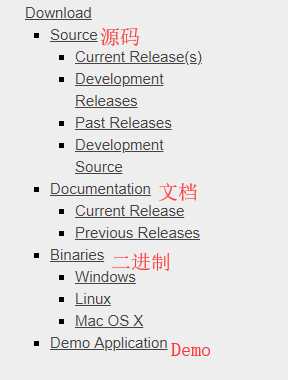
源码下载:它是如何将tomcat给嵌入进来的 https://mapserver.org/download.html
git:https://github.com/mapserver/mapserver
已经有168个版本的release了![]()
原文:https://www.cnblogs.com/2008nmj/p/11052761.html